IndianOcean – US Torpedo Strike on Iranian Warship Sparks Maritime Authority Debate
IndianOcean – The recent sinking of the Iranian naval vessel IRIS Dena in the Indian Ocean has reignited discussion about who truly holds authority over vast international waters and how maritime rules apply during military operations. The incident, which occurred earlier this week near Sri Lanka, has drawn attention from analysts, naval experts and policymakers across several countries.
US Submarine Attack Near Sri Lanka
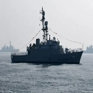
According to reports, the Iranian warship was struck by a torpedo launched from a United States Navy submarine on March 4 while sailing through waters south of Sri Lanka. The vessel had reportedly been returning to Iran after taking part in naval exercises in Visakhapatnam, located in India’s Andhra Pradesh state.
The strike occurred roughly 40 nautical miles south of the Sri Lankan city of Galle. US officials described the location as international waters, emphasizing that the area does not fall under the direct legal authority of India or any other country. Although the location lies within Sri Lanka’s maritime zone, international maritime law allows naval passage through such waters.
Footage released by the Pentagon reportedly showed a large explosion near the rear section of the ship. Subsequent images indicated the vessel eventually sinking beneath the ocean surface. International media outlets reported that the dramatic visuals highlighted the intensity of the attack.
Understanding International Waters
The incident has renewed interest in how oceans are governed under global law. Areas commonly described as international waters begin beyond the Exclusive Economic Zone, or EEZ, of coastal nations. This zone typically extends up to 200 nautical miles from a country’s shoreline.
Beyond that limit, the ocean is considered part of the high seas. In these regions, all nations are granted certain freedoms, including navigation, fishing and scientific research. However, resources located on or beneath the seabed are regulated through international agreements and organizations.
In the case of the IRIS Dena, the ship was reportedly operating within Sri Lanka’s EEZ but still within waters considered open for international navigation under existing maritime rules.
Why the Indian Ocean Carries India’s Name
The episode has also led to renewed curiosity about why the Indian Ocean is the only ocean named after a country. The name originates largely from geography rather than ownership.
India occupies a central position along the northern edge of the ocean. The Indian peninsula extends deep into the surrounding waters, historically serving as a major reference point for traders, explorers and mapmakers. The ocean covers around 70 million square kilometres and links the continents of Asia, Africa and Australia.
Despite the name, the Indian Ocean is not under India’s control. Like all global oceans, its governance is determined by international law rather than national ownership.
Maritime Zones and India’s Jurisdiction
Rules governing ocean territories are defined under the United Nations Convention on the Law of the Sea, widely known as UNCLOS. Adopted in 1982 and ratified by more than 160 countries, the agreement outlines how coastal nations manage nearby waters.
Under these rules, India’s territorial waters extend 12 nautical miles from its coastline, where the country exercises authority comparable to its land territory. Beyond this lies a contiguous zone that reaches up to 24 nautical miles, allowing enforcement of certain laws related to customs, immigration and public health.
Further outward is India’s Exclusive Economic Zone, stretching up to 200 nautical miles. This area covers approximately 2.3 million square kilometres and gives India rights to explore and utilize natural resources such as oil, natural gas and fisheries.
However, ships from other countries are generally allowed to pass through these waters under internationally accepted navigation rights.
Strategic Importance of the Region
Even though India does not control the broader Indian Ocean, the region holds enormous strategic value for the country. Reports indicate that more than 90 percent of India’s trade by volume moves through sea routes across the ocean.
To safeguard these vital shipping lanes, India maintains a significant naval presence in the region. Aircraft carriers, submarines and surveillance systems operate alongside military installations in the Andaman and Nicobar Islands, which serve as a key monitoring point for maritime traffic.
These deployments are aimed at protecting commercial routes and maintaining stability across a region that sees constant movement of military and merchant vessels.
Experts React to the Incident
The sinking of the IRIS Dena has generated varied reactions among security analysts. Some experts view the incident as a demonstration of ongoing geopolitical tensions in global waters.
Strategic affairs analyst Brahma Chellaney commented on social media that the event could have broader implications for regional diplomacy. He suggested that while Washington may view the strike as a legitimate wartime action against an opposing naval asset, it also raises questions about how such actions affect regional influence and strategic relationships.
The event has therefore become more than just a military encounter. It has prompted a wider discussion about naval power, maritime law and the balance of authority across one of the world’s most important oceans.